StudentShare
Contact Us
Sign In / Sign Up for FREE
Search
Go to advanced search...
Free

How Does Port Location Affect Port Traffic - Case Study Example

Cite this document
Summary
This paper "How Does Port Location Affect Port Traffic" focuses on the fact that the word ‘port’, derived from the Latin word ‘portus’, means gate or gateway. Points of convergence between land and marine domains of circulation, ports are bound by the need to serve ships …
Download full paper File format: .doc, available for editing
GRAB THE BEST PAPER96.3% of users find it useful
How Does Port Location Affect Port Traffic
Read Text Preview

Extract of sample "How Does Port Location Affect Port Traffic"

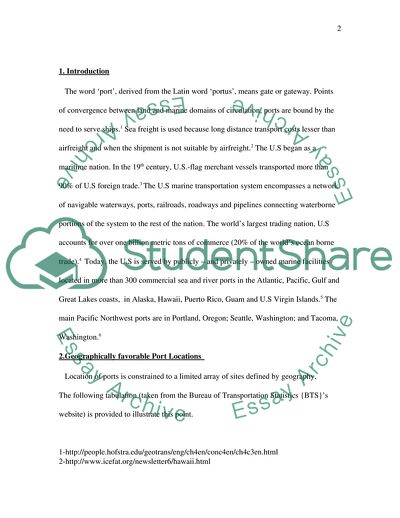
How Does Port Location Affect Port Traffic In Terms Of Cargo Volume And The Number Of Ships Handled Contents 1. Introduction 2. Geographically favorable locations 3. Maritime access 4. Maritime interface 5. Infrastructure 6. Land access 7. Urban and environmental pressures 8. Emergence of container transportation 9.Maritime companies 10.Industrial plant locations 11.Port and industry partnerships 12.Foreign trade zones 13.Ports during wartime 14.Ports during international relief operations 15.Ports combating terrorism 16.Conclusion 1. Introduction The word ‘port’, derived from the Latin word ‘portus’, means gate or gateway. Points of convergence between land and marine domains of circulation, ports are bound by the need to serve ships.1 Sea freight is used because long distance transport costs lesser than airfreight and when the shipment is not suitable by airfreight.2 The U.S began as a maritime nation. In the 19th century, U.S.-flag merchant vessels transported more than 90% of U.S foreign trade.3 The U.S marine transportation system encompasses a network of navigable waterways, ports, railroads, roadways and pipelines connecting waterborne portions of the system to the rest of the nation. The world’s largest trading nation, U.S accounts for over one billion metric tons of commerce (20% of the world’s ocean borne trade).4 Today, the U.S is served by publicly – and privately – owned marine facilities located in more than 300 commercial sea and river ports in the Atlantic, Pacific, Gulf and Great Lakes coasts, in Alaska, Hawaii, Puerto Rico, Guam and U.S Virgin Islands.5 The main Pacific Northwest ports are in Portland, Oregon; Seattle, Washington; and Tacoma, Washington.6 2.Geographically favorable Port Locations Location of ports is constrained to a limited array of sites defined by geography. The following tabulation (taken from the Bureau of Transportation Statistics {BTS}’s website) is provided to illustrate this point. 1-http://people.hofstra.edu/geotrans/eng/ch4en/conc4en/ch4c3en.html 2-http://www.icefat.org/newsletter6/hawaii.html 3-“Containerization” World Book Encyclopedia, Volume 4 4-http://www.house.gov/transportation/cgmt/05-23-01/05-23-01memo.html 5-http://people.hofstra.edu/geotrans/eng/ch4en/conc4en/ch4c3en.html 6-“U.S.A Business” page 411 TABLE 8. U.S. Maritime Freight Gateways, Ranked by Value and Weight, 2003 Value (current $, millions) Excel | CSV Rank by value Port name U.S. maritime trade Exports Imports 1 Port of Los Angeles, CA 122,051 16,865 105,186 2 Port of New York and New Jersey 101,176 24,303 76,873 3 Port of Long Beach, CA 95,863 17,163 78,700 4 Port of Houston, TX 49,893 21,439 28,454 5 Port of Charleston, SC 39,375 13,374 26,000 6 Port of Norfolk Harbor, VA 29,495 11,026 18,469 7 Port of Tacoma, WA 26,332 5,203 21,129 8 Port of Baltimore, MD 25,956 5,686 20,270 9 Port of Oakland, CA 25,144 7,762 17,382 10 Port of Seattle, WA 23,078 5,688 17,390 11 Port of Savannah, GA 21,349 7,418 13,931 12 Port of New Orleans, LA 19,411 11,237 8,174 13 Port of Miami, FL 16,610 6,826 9,785 14 Port of Portland, OR 11,810 2,966 8,844 15 Port of Jacksonville, FL 11,235 2,334 8,901 16 Port Everglades, FL 10,499 4,348 6,151 17 Port of Philadelphia, PA 10,315 634 9,681 18 Port of Morgan City, LA 10,108 181 9,927 19 Port of Corpus Christie, TX 9,859 1,957 7,902 20 Port of Beaumont, TX 9,616 954 8,662 Total, U.S. waterborne trade (all seaports)   811,086 206,205 604,881 Total, top 20 seaports   669,174 167,362 501,812 Top 20 seaports as share of U.S. maritime total (percent)   82.5 81.2 83.0 Most ports take advantage of a natural coastline or natural site along rivers. For instance, New York has traditionally acted as the gateway of the North American Midwest through the Hudson/Erie canal system.7 After World War II most terminals were relocated to take advantage of new trade routes and keeping in mind the volume of trade generated with friendly trade partner countries. It can be seen from the preceding statistics of the year 2003 that due to their strategic geographical locations, the Port of Los Angles and the Port of New York and New Jersey were each able to generate business exceeding $ 100 million in the year 2003; comparatively, the Port of Philadelphia could manage just a tenth of that figure, generating business of just slightly over $ 10 million. The figures presented in the table are the end result of trade in direct proportion to the volume of cargo and the number of ships handled by those ports; the higher the amount of business, the higher the volume of cargo and number of ships handled and vice versa. The huge difference seen is a direct result of the favorable geographical locations of the former two ports and the disadvantageous location of the Port of Philadelphia.8 3.Maritime Access. This is the ‘physical capacity’ of the port to accommodate ship operations which has to be adequate in order for ships to maintain a steady stream of cargo movement. The ‘tidal range’ (difference between the high and low tide), is important as normal ship operations cannot handle variations of more than 3 meters.9 Yearly tidal datum statistics and tide 7-http://people.hofstra.edu/geotrans/eng/ch4en/conc4en/ch4c3en.html 8-http://www.bts/gov/publications/americas_freight_transportation_gateways_/ introduction_and_overview/ 9-http://people.hofstra.edu/geotrans/eng/ch4en/conc4en/ch4c3en.html ranges for National Oceanic and Atmospheric Administration/National Ocean Service long-term statistics in the tide range guage were compiled and used to calculate their trends and statistical significance.10 Another factor is the channel and berth depths suitable to accommodate modern cargo ships.11 Without unobstructed navigation channels, deep draft ships cannot travel safely into ports.12 Channel depths are inadequate in many U.S ports to receive the largest containerships.13 Channel depth can be increased by dredging, especially in ocean ports.14 Dredging keeps ports open, safe and competitive. The volume of traffic in all these ports is dependant heavily on their close location to points of supply of such materials in addition to availability of inland transport facilities.15 4.Maritime Interface. Defined as the ‘amount of space’ available to support maritime access, it is basically the ‘amount of shoreline’ available for maritime activity.16 The Strategic Environmental Assessment (SEA) created a digital vector data of the contiguous United States shoreline. Divided into four major regions (West Coast, East Coast, Gulf of Mexico Coast and Great Lakes Coast), it provides accurate spatial representation of the United States shoreline.17 This attribute is very important because ports are linear entities. A port having excellent maritime access (deep water waterways), may not have enough land 10-http://pubs.asce.org/WWWdisplay.cgi?0302310 11-http://people.hofstra.edu/geotrans/eng/ch4en/conc4en/ch4c3en.html 12-http://www.aapa-ports.org/industryinfo/americasports.htm 13-http://www.house.gov/transportation/cgmt/05-23-01/05-23-01memo.html 14- http://people.hofstra.edu/geotrans/eng/ch4en/conc4en/ch4c3en.html 15- http://www.aapa-ports.org/industryinfo/americasports.htm 16- http://people.hofstra.edu/geotrans/eng/ch4en/conc4en/ch4c3en.html 17- http://www.tobin.com/psUSVectorShorelineData.asp available to guarantee its future development and expansion. Obviously, this factor will affect number of ships handled and volume of cargo. 5.Infrastructure. In order for a port to be efficiently used, to process a large growing volume of cargo, and handle many ships, it must have a well-built infrastructure like terminals, piers, basins, cranes and warehouses. Providing investment has become a challenge for many ports.18 U.S public ports invested around $ 24.4 billion since 1946. Over the past 5 years, hundreds of millions of dollars have been invested by the U.S in new facilities and it will continue to invest more than $ 1 billion each year.19 Investment will also be diverted to ports hit by calamities like New Orleans, the worst hit port by Hurricane Katrina; it was estimated that $ 1 billion was needed for rebuilding and relocating operations.20 U.S Ports are exposed to significant financial losses after catastrophic events for which they have to prepare. Appropriate operating strategies can be evaluated using a simulator model for port operations.21 6.Land Access. U.S ports work hand-in-hand with the nation’s trucking companies, railroads and airports to offer the most efficient transportation system in the world.22 Access from the port to industrial complexes and markets ensures its growth and importance. This requires efficient inland distribution systems such as fluvial, rail (mainly for containers) 18-http://people.hofstra.edu/geotrans/eng/ch4en/conc4en/ch4c3en.html 19-http://www.aapa-ports.org/industryinfo/americasports.htm 20-http://www.forbes.com/logistics/2005/11/09/ new-orleans-port-interview-cx_rm_1109orleans.html 21-“Advancing Mitigation Technologies & Disaster Response for Lifeline Systems” page 432 22-http://www.aapa-ports.org/industryinfo/americasports.htm and road transportation. The land access to ports located in densely populated areas is facing increasing congestion.23 This causes delays and raises transportation costs.24 Whether traffic is being generally solely or mostly by the cargo hub traffic (e.g., Luis Munoz Marin International Airport), or by a combination of the cargo traffic and regular public traffic using the same roads (e.g., Alameda Corridor and Kedzie Avenue), the issues of congestion and delays eventually arise. The solution typically requires of improvement of the road and highway system near the cargo hub terminal facility.25 For example, the ports of Los Angeles and Long Beach have invested massively to develop Alameda rail corridor to promote inland access and reduce truck congestion. 7.Urban and Environmental Pressures. Ports have a complex set of conflicting relationships with the cities they service. As time passes, changes in ships and handling give rise to new port site requirements.26 Transport of bulk liquids requires the use of tankers.27 This resulted in new site requirements for ports, needing additional dock space, greater depths of water, larger terminal space and more efficient inland road and rail access. The pressure of ports on their cities is even more demanding than airports because they have to be adjacent to deep water.28 Public support for port infrastructure modernization has softened due to competing demands for public investment funds for non-maritime-related purposes in the port area (e.g., for residential and commercial developments, recreation sites, marine 23-http://people.hofstra.edu/geotrans/eng/ch4en/conc4en/ch4c3en.html 24-http://www.aapa-ports.org/industryinfo/americasports.htm 25-“Financing & Improving Land Access to U.S Intermodal Cargo Hubs” pg 7 26-http://people.hofstra.edu/geotrans/eng/ch4en/conc4en/ch4c3en.html 27-“Maritime Economics” page 406 28-http://people.hofstra.edu/geotrans/eng/ch4en/conc4en/ch4c3en.html habitat preservation, restoration).29 Proper handling of this problem is crucial to the future of the port and will affects its volume of cargo traffic and the number of ships handled. 8.Emergence of Container Transportation. Port dynamics underwent a radical change with the emergence of container transportation.30 Containerization has profoundly changed the conception of transportation.31Containerization is the method of shipping freight by placing it inside large metal boxes called containers. Containerization helps prevent damage to the freight, and reduces the time and cost required to load and unload it.32 Four of the busiest container-ports in the U.S are located on the West Coast: Los Angeles, Long Beach, Seattle and Oakland.33 The busy ports of New York and New Jersey are both major container-ports.34 By the end of the 20th century, containers were carrying over 95% of general cargoes moving between continents.35At the beginning of 2005, the container ship fleet grew by 8.4% to 98.1 million deadweight or 10.9% of the world fleet.36 International general cargo trade now exceeds 1.2 billion metric tons; the containerized portion approaches 100%; dominant flows in containerized trades are found in East-West arteries (between Western Europe and U.S East Coast, between Asia and U.S West 29-“Ship Handling Simulation: Application to Waterway Design” page 4 30- http://people.hofstra.edu/geotrans/eng/ch4en/conc4en/ch4c3en.html 31- http://www.ie.msstate.edu/ncit/tech_trans/ 2.Donovan-intermodal%20Transportation%20in%Historical%20Perspective.htm 32-“Containerization” World Book Encyclopedia, Volume 4 33-“U.S.A Business” page 411 34-“Lonely Planet U.S.A” page 167 35- http://www.ie.msstate.edu/ncit/tech_trans/ 2.Donovan-Intermodal%20Transportation%20in%Historical%20Perspective.htm 36- http://www.unctad.org/Templates/webflyer.asp?docid= 6501&intItemID=1634&lang=1 Coast).37 Cities, states and regions made large infrastructure investments in container-ports as they struggled to remain players in an industry that was simultaneously expanding and consolidating.38 9.Maritime Companies. Maritime companies direct maritime traffic to certain ports by having partnerships with such ports, resulting in a gigantic boost of cargo volume and number of ships handled. The presence of excellent port infrastructure does not necessarily guarantee traffic, as maritime companies can select the ports they service as business opportunities change.39 For instance, more than 30 container steamship lines call on the Port of Los Angeles regularly.40 On 1st November 2000, P&O Nedlloyd and P&O Ports formed a new joint venture company – Port Newark Container Terminal LLC (PNCT) – and signed a 30-year lease with the Port Authority of New York and New Jersey (PANYNJ) to operate a 158-acre container terminal in Port Newark, New Jersey.41 On 11th April 2003, Japanese shipping company “K” Line and the North Carolina State Ports Authority celebrated their partnership. “K” Line began service between the Port of Wilmington and the Far East under agreement including Yang Ming Line of Taiwan, Haijin Shipping company of South Korea and Cosco shipping company of China.42 On 12th July 2005, the Port Tacoma Commission celebrated the 20th anniversary of its partnership with Maersk Sealand. Over these 20 years, Maersk Sealand saw its terminal in Tacoma grow from 76 37- http://www.house.gov/transportation/cgmt/hearing/05-03-00/helmick.html 38- http://www.ie.msstate.edu/ncit/tech_trans/ 2.Donovan-Intermodal%20Transportation%20in%Historical%20Perspective.htm 39- http://people.hofstra.edu/geotrans/eng/ch4en/conc4en/ch4c3en.html 40- “U.S.A Business” page 411 41-http://www.ponl.com/topic/home_page/language_en/newsroom/news/ latest_news?action=item&usetemplate=archive_news_item&resourceitem_no=3893 42-http://www.ncports.com/web/ncports.nsf/pages/04112003 acres to 132 acres. Dick Marzano, Port of Tacoma Commission spokesperson said: “In 2005 we expect to eclipse 2 million TEUs. We thank Maersk Sealand for being a partner in our success.”43 10.Industrial Plant Locations. Ports play a major role in industrial plant locations. Many manufacturing and processing industries locate their plant at or near waterfront sites to take advantage of low-cost inbound transportation of raw material for production, and outbound shipments of finished products to both export and domestic markets. The close proximity of such industries thus increases the volume of cargo transacted and the number of ships handled by the port. 11.Port and Industry Partnerships. Some U.S public ports enter into partnerships with private Industry to finance expansion investments. For instance, in January 2005 Toyota Logistics Services Inc. and the Port of Portland (Oregon) celebrated the completion of $ 40 million auto import and processing facility at the Port’s Terminal 4. Toyota invested approximately $ 30 million and Port of Portland invested around $ 10 million for Infrastructure expansion. As a result, business has increased significantly and will continue to increase as Toyota expects to process more than 175,000 imported and domestically built Toyota, Lexus and Scion vehicles annually through this facility.44 12.Foreign Trade Zones. Foreign trade zones are located on port property. They develop trade between their mother country and the country in which they are based. They encourage exports from 43- http://washingtonports.org/port_information/portnews/071205tacoma.htm 44- http://www.aapa-ports.org/industryinfo/americasports.htm the base country to their mother country, and at the same time, facilitate imports from their mother country to the country in which they are based. These foreign trade zones therefore are responsible for a sizeable increase in the volume of cargo handled by the port and the number of ships that pass through it.45 13.Ports during Wartime. Public ports serve a critical function during wartime. To maximize DOD (Department of Defense) capability and minimize its cost, defense sealift relies heavily on the U.S commercial sector. DOT (Department of Transportation) helps provide for a seamless, time-phased transition from peace to war operations while balancing the defense and commercial elements of the U.S transportation system.46 The Military Sealift Command (MSC) and Military Traffic Management Command (MTMC) use public ports to preposition mobility forces and equipment. For instance, selected U.S ports were used during Operation Enduring Freedom and Operation Iraqi Freedom since the conflicts began in 2003.47 In all, MARAD (The Mission of Maritime Administration) had 40 vessels supporting Operation Iraqi Freedom, which maintained an operation tempo of 98%.48 Thus the flow of cargo traffic through such strategically located ports was tremendous during that period. 14.Ports during International Relief Operations. U.S ports supplied relief missions both inside the U.S and overseas during natural disasters, such as the tsunami relief efforts in Indian ocean countries, and to Hurricane 45- http://www.aapa-ports.org/industryinfo/americasports.htm 46-http://www.dot.gov/PerfPlan2004/homelandperf.html 47- http://www.aapa-ports.org/industryinfo/americasports.htm 48- http://www.navyleague.org/sea_power/almanac_jan_04_maritime_admin.php Katrina affected areas.49The Port of Morehead City played an essential role in Hurricane Katrina’s relief efforts. Within a 24-hour period, Navy ships ‘USS Whidbey Island’ and ‘USS Shreveport’ were loaded with a substantial response package and dispatched to New Orleans.50 The location of ports close to industries supplying relief materials such as food, medicine, and shelters was a major factor that enabled these ports to channel a huge volume of cargo and handle a large number of ships during such relief operations.51 15.Ports combating Terrorism The horrific attacks of September 11, 2001 had an immediate impact on the movement of goods its seaports and airports. U.S seaports were closed, container movement stopped, and arriving vessels were held outside U.S ports by the Coast Guard. In the days following September 11, a situation of high alert constantly prevails in all U.S seaports involving increased inspection of goods. These safety procedures gain the confidence of maritime companies, importers and exporters, thus contributing to the port’s increased handling of ships and volume of cargo.52 16.Conclusion. World sea-borne trade expanded 4.3% in 2004 to 6.76 billion metric tons transported. It is expected to grow at a similar rate in 2005, reports UNCTAD’s “Review of Maritime Transport 2005” released on 7th November 2005.53 By 2020, international trade will triple, with over 90% moving via the ocean. Accordingly, the entire U.S transportation 49- http://www.aapa-ports.org/industryinfo/americasports.htm 50- http://www.ncports.com/web/ncports.nsf/pages/051007+Hurricane+Relief 51- http://www.aapa-ports.org/industryinfo/americasports.htm 52-“Global Materials Compliance Handbook” page 311 53- http://www.unctad.org/Templates/webflyer.asp?docid= 6501&intItemID=1634&lang=1 infrastructure must be able to handle this projected increase, so that its ports will get their just share of traffic volume and number of ships handled.54 Ports are critical to the U.S economy as 95% of all foreign trade passes through them. The marine transport system supports 13 million jobs and contributes $ 742 billion to U.S domestic product.55 Balancing the need for greater maritime security with the realities of commercial shipping is the clearest and most important challenge facing the American maritime industry.56 54-http://www.yoto98.noaa.gov/yoto/meeting/mar_trans_316.html 55-“Geospatial Information Infrastructure for Transportation Organizations” page 64 56- http://www.navyleague.org/sea_power/almanac_jan_04_maritime_admin.php References cited American Association of Port Authorities. No date. America’s Ports: Gateways to Global Trade (Yesterday, Today and Tomorrow). Beavers, James. E. 2003. Advancing Mitigation Technologies & Disaster Response for Lifeline Systems, Reston (USA), ASCE Publications. Campbell Jeff, Chilcoat Loretta, Derby Susan and Nystrom Andrew Dean. March 2004. Lonely Planet USA. Australia. Lonely Planet Publications Pty Ltd. Donovan, Arthur. No Date. Intermodal Transportation in Historical Perspective. USMAA. http://www.ie.msstate.edu/ncit/tech_trans/ 2.Donovan-Intermodal%20Transportation%20in%Historical%20Perspective.doc Flick, Reinhard E. July/August 2003. Trends in United States Tidal Datum Statistics & Tide Range. http://www.pubs.asce.org/WWWdisplay.cgi?0302310 Helmick, Jon S. 3rd May 2000. U.S.Department of Transportation:Maritime Administration. Malone, Robert. Forbes.com. 11th September 2005. The Port of New Orleans: A Call for Help. Marine Board, Commission on Engineering & Technical system, National Research Council. 1992. Ship Handling Simulation: Application to Waterway Design. USA. National Academy of Sciences. Nedlloyd. No date. P&O Nedlloyd and P&O Ports sign lease for Port Newark Container terminal. http://www.ponl.com/topic/home_page/language_en/newsroom/news/ latest_news?action=item&usetemplate=archive_news_item& resourceitem_no=3893 North Carolina Ports. News Release. 11 April 2003. “K” Line & NC State Ports Authority Celebrate Partnership. North Carolina Ports. News Release. 7 October 2005. NC State Ports Help 82nd Airborne U.S Marine Corps Hurricane Relief Office of Congressional & Public Affairs, Maritime Administration. Almanac. 2004. Navy League of the United States: Citizens in Support of the Sea. < http://www.navyleague.org/sea_power/almanac_jan_04_maritime_admin.php> Phyper John, Ducas Philippe and Baish, Peter J. 2004. Global Materials Compliance Handbook. New Jersey USA. John Wiley & Sons Inc. Rodrigue Jean-Paul Dr. 23rd October 2005. The Port Authority of New York & New Jersey. Rodrigue Jean-Paul Dr., and Slack Brian Dr. 22nd December 2005. Port & Rail Terminals. Shafran, Isaac & Strauss-Wieder, Anne. 2003. Financing & Improving Land Access to U.S Intermodal Cargo Hubs. U.S.A. TRB Publications Shippey, Karla and Nolan, James. 1995. U.S.A Business-The Portable Encyclopedia for doing business with the United States. U.S.A. World Trade Press. Stopford, Martin. 1997. Maritime Economics. Second Edition. London U.K. Routledge Publications. The Sub-Committee on Coast Guard & Maritime Transportation. 23rd January 2005. Port & Maritime Transport Congestion. Tobin Directional Survey Data. Tobin-Off-the-Shelf. No date. Tobin U.S Vector Shoreline Data. Transportation Research Board. 2004. Geospatial Information Infrastructure for Transportation Organizations. U.S.A. TRB Publications UNCTAD>ORG. News Release 2005. 7th November 2005. World Seaborne Trade. The U.S Department of Transportation. No date. About DOT/FY2004 Performance Plan. http://www.dot.gov/PerfPlan2004/homelandperf.html The U.S Department of Transportation. No date. The U.S Marine Transportation System. Read More
Cite this document
  • APA
  • MLA
  • CHICAGO
(How Does Port Location Affect Port Traffic Case Study, n.d.)
How Does Port Location Affect Port Traffic Case Study. Retrieved from https://studentshare.org/macro-microeconomics/1702960-port-location-is-one-of-several-factors-determining-how-a-port-develops-how-does-location-affect-port-traffic-in-terms-of-the-cargo-volume-and-the-number-of-s
(How Does Port Location Affect Port Traffic Case Study)
How Does Port Location Affect Port Traffic Case Study. https://studentshare.org/macro-microeconomics/1702960-port-location-is-one-of-several-factors-determining-how-a-port-develops-how-does-location-affect-port-traffic-in-terms-of-the-cargo-volume-and-the-number-of-s.
“How Does Port Location Affect Port Traffic Case Study”, n.d. https://studentshare.org/macro-microeconomics/1702960-port-location-is-one-of-several-factors-determining-how-a-port-develops-how-does-location-affect-port-traffic-in-terms-of-the-cargo-volume-and-the-number-of-s.
  • Cited: 0 times

CHECK THESE SAMPLES OF How Does Port Location Affect Port Traffic

Simulation Of Routing Protocols

We calculated energy consumption of four ad hoc routing protocols (AODV, DSR, DSDV, and TORA) by a straightforward traffic model in which a only some nodes send data over a multi-hop path.... This makes sagacity since a priori protocols are continually expend energy pre-computing routes, even although there is no traffic passing on these routes (S.... hat Effect Does A Change Of Mobility Model Have On The Effectiveness Of Routing Protocols In Ad Hoc complexSince it is unfeasible to evaluate the behavior of the network if the traffic nodes run out of energy previous to the transit nodes, we give traffic nodes inestimable energy....
5 Pages (1250 words) Essay

Supply Chain Management: Gulfstream Really Flies

Savannah, located in proximity to the Atlantic Ocean, has a deep water port that permits direct shipment and short portage to the assembly plant.... hellip; The purpose of this paper is to discuss the details of the case study in terms of the three questions posed as well as how Gulfstream itself has managed to create such an efficient system. From a logistical standpoint, what are all of the ways in which Gulfstream uses location to maximize the effectiveness of its supply chain Gulfstream has taken supply chain efficiency and raised it to an art form....
5 Pages (1250 words) Essay

Where The Five Functional Areas Of Network Management (FCAPS) Are Not Adhered To

The intermittent problem could also occur as a result traffic overload, which would cause packets to be lost.... Sometimes the management system indicates failure, when in actuality data traffic is flowing normally.... Due to multiple servers at single location cannot fulfill the requirement of the organisation....
12 Pages (3000 words) Essay

Film Tourism in the USA

Mutiny on the Bounty (1935) was the first movie that attracted huge number of visitors to the location of the shooting (Roesch, 2009, p.... 8), and Tahini turned into a major tourist location only because the film was shot there.... Since 1935, movies have changed how they impact the audiences.... They realized how the success of the movie can contribute to business of tourism....
8 Pages (2000 words) Essay

Retailing as a Critical Part of Modern Society

Even though numerous retail shops have stocks that determine discriminant features, few have tried to account for how these features result in the contentment of personal shopping motives.... The essay "" describes that retailing is a critical part of modern society because of convenience....
5 Pages (1250 words) Essay

An Opportunity of a Lifetime to Change the Whole Parking Set-Up in Their Universities

The Harvard University has a large number of students and staff and the most prevalent location is on the main campus, the Harvard school plays a major role in conditioning the environs transport patterns.... As this paper finds out, it will take the participation of various groups to solve the parking problem....
10 Pages (2500 words) Research Paper

How New Technologies Can Affect People Daily Lives

For instance, women will call her husband to pick their children up from school or give a call and tell the school that she will be late a little because she stuck in the traffic.... The essay "How New Technologies Can affect People Daily Lives" provides a viewpoint that modern technologies such as mobile communications and video hosting both facilitate and diversify the lives of users, and can create problems (for example, deprive privacy and cause an accident)....
7 Pages (1750 words) Essay

Effects and Causes of the Tsunami

This tragedy created awareness in the lives of many people on how they deal with tragedies and other related crisis.... Many countries started coming up with ways by which to handle a tragedy such as the tsunami and to set up programs that keep them prepared on how to handle tsunamis just incase they occur.... The tsunami was quite new to most people and they had to understand its cause and how they can handle the issue efficiently....
10 Pages (2500 words) Essay
sponsored ads
We use cookies to create the best experience for you. Keep on browsing if you are OK with that, or find out how to manage cookies.
Contact Us